Davis Creek Regional Park
Davis Creek Regional Park is now open with limited capacity. The campground and equestrian parking lot remain closed until further notice as we continue the restoration and rebuilding efforts. Please be cautious of on-going work and equipment in the park! The Nature and Ophir Creek Trails are both open. The Discovery Trail remains closed until further notice. Keep an eye on the 'Washoe County Regional Parks and Open Space' Facebook page for future updates as well as additional opportunities for volunteer work days!
Living With Wildfire, Wild Nevada Episode 6, Season 7 - Take a look at not only the importance of being fire aware, but also how prevention, recovery and fire science work together to help us safely and sustainably enjoy the state's unique landscapes.
Thank you 2 News Nevada for covering the recent 'Up! The Creek' Benefit Event. If you were unable to make the event and still desire to donate towards the fire restoration, you can visit our Make A Donation - Washoe County page. Be sure to choose Davis Creek Regional Park from the dropdown menu and put "Fire Restoration" in the 'Other Gift Dedication' box. Thank You!
25 Davis Creek Road, Washoe Valley, NV 89704 (For directions, view the parks Google map)
Park Ranger Office: (775) 849-0684
For current weather conditions, please reference the National Weather Service Forecast for the area.
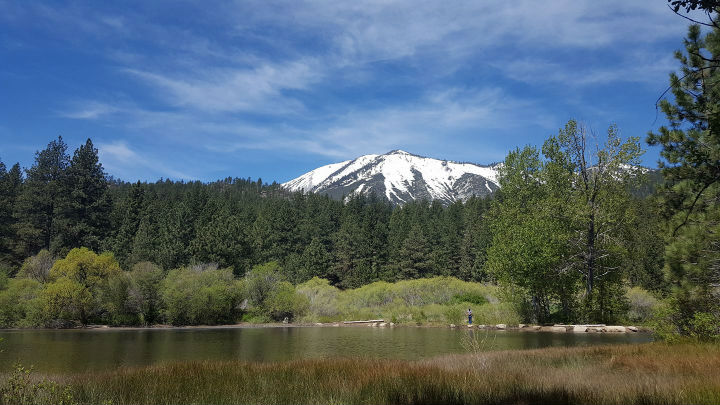
Located 20 miles south of Reno, this year-round recreational destination includes over 200 acres of pine and sage desert nestled against Slide Mountain on the eastern slope of the Sierra Nevada Mountains. Outdoor recreational opportunities include a campground with hot showers, scenic picnic areas surrounding a small fishing pond, hiking trails, an equestrian friendly trailhead, two reservable group camping areas, a large reservable group picnic area, an outdoor amphitheater and various interpretive programs. Be prepared for outstanding views of Washoe Lake and Slide Mountain while visiting Davis Creek Regional Park. Park rules and regulations are based on the Washoe County Code Chapter 95.
Recreation at Davis Creek Pond
- A current valid fishing license or permit issued by the Nevada Department of Wildlife is required for all anglers over the age of 12. Purchase your annual license or one (1) day permit here.
- Fishing hours are 8:00 a.m. to 30 minutes before park closing (posted at the park entrance)
- There is a limit of three (3) fish per angler, including resident youth anglers (under age 12). Non-resident youth anglers may keep one (1) fish.
Wildlife
Davis Creek Regional Park is home to a wide variety of plant and animal species. Please reference a partial species list for the park. Also, be sure to check out the iNaturalist observations within the park.
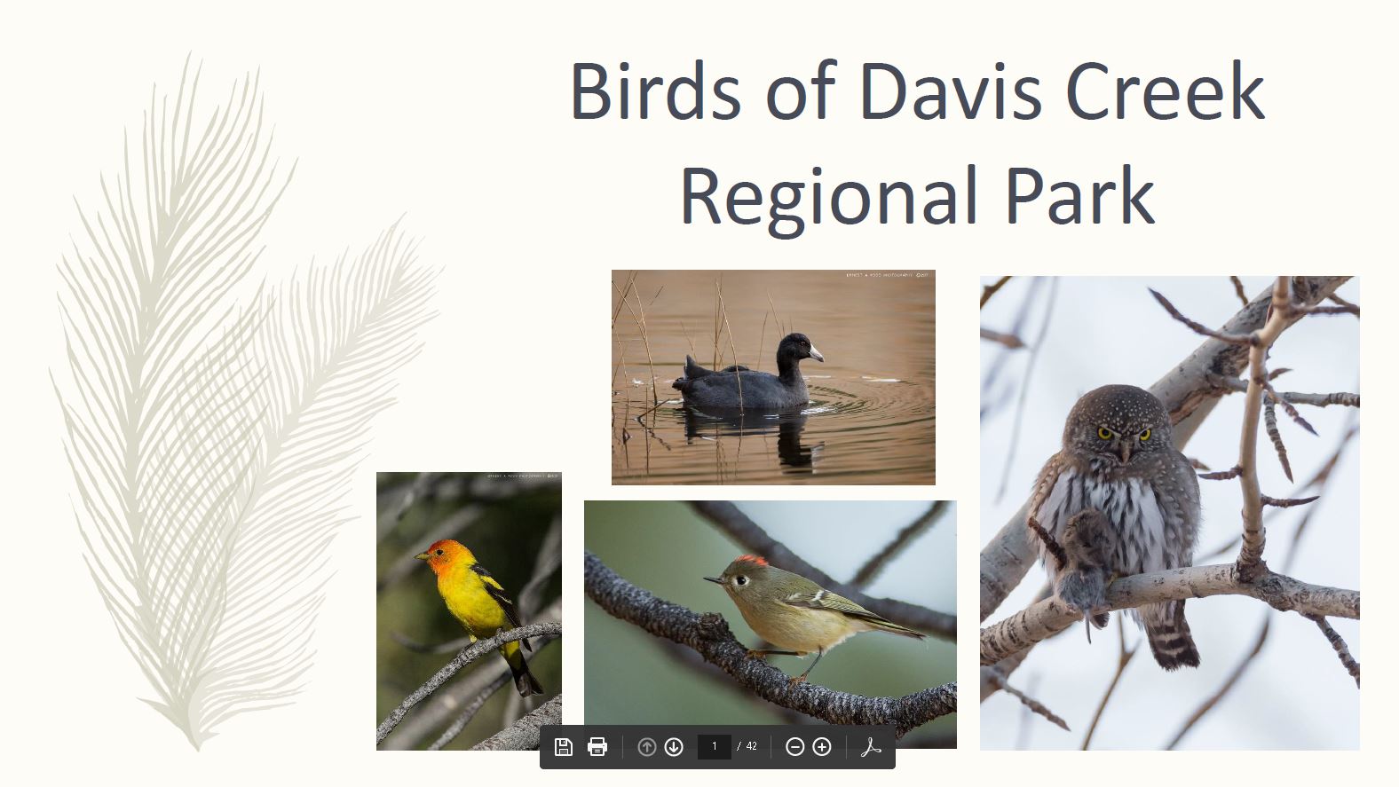
The park is home to over 100 different species of birds! For more information, please download and print the .pdf bird guide for Davis Creek Park. You may also reference this e-bird species list for the park. To view photos of some of these bird species, reference the Facebook photo album.
Picnic Areas
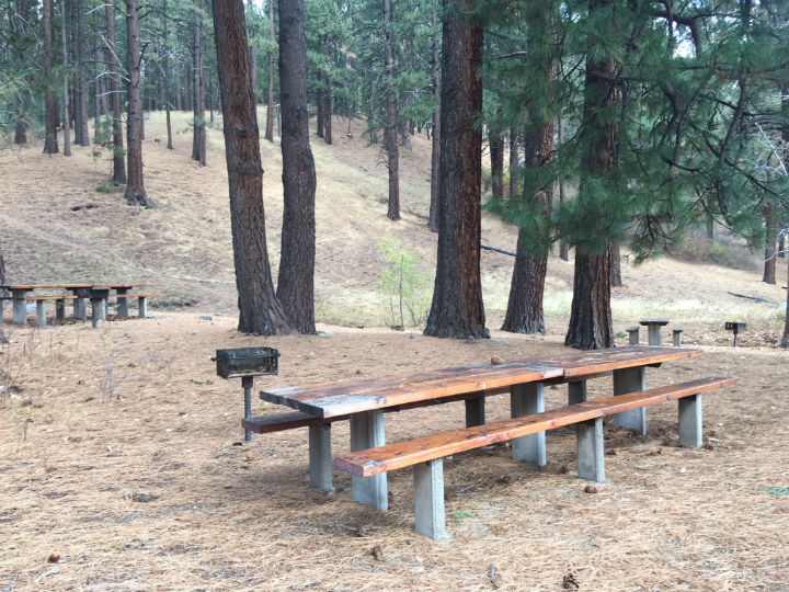
The day use individual picnic areas are available on a first come, first serve basis. For information on reserving a group picnic area, please reference the Lakeview Picnic Area page or contact Park Reservations at (775) 823-6501 or reserveparks@washoecounty.gov
Please know that we are in bear country requiring visitors to store food and trash properly. All trash goes in the dumpsters which need to remain latched at all times. No food should be left out unattended. Thank You!
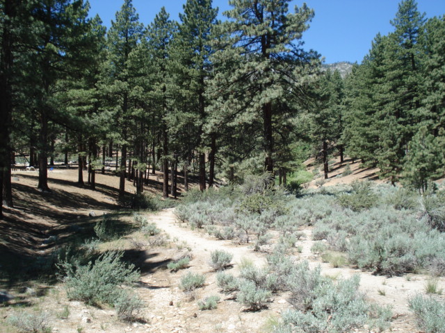
Trails
-
.7 mile Nature Trail around the pond - For more information, please reference the interpretive trail guide
-
1.7 mile Discovery Trail that circles the park (CURRENTLY CLOSED)
-
7.5 mile Ophir Creek Trail, which winds up the mountain to Price Lake and the Tahoe Meadows - For more information, please reference the Ophir Creek Trail map
Programming
Interpretive programs include guided hikes, Story Stroll, Junior Ranger Activity Guide and selected events in the park's outdoor amphitheater. Information about upcoming park events and programs can be found on our calendar of events page.
Campground (CURRENTLY CLOSED)
Please Note: All reservable spaces at Davis Creek Regional Park require a 15 day advanced notice. This includes the reservable individual campsites, the Tent Group Camp Area, the RV Group Camp Area, and the Lakeview Picnic Area.
Media
Interpreting Park Biodiversity Through Wildlife Photography (2020 Virtual Presentation)
Portions of the 1995 TV-movie 'Bonanza: Under Attack' were filmed at Davis Creek Regional Park. Click the links below for more information:
Bonanza: Scenery of the Ponderosa
Park History
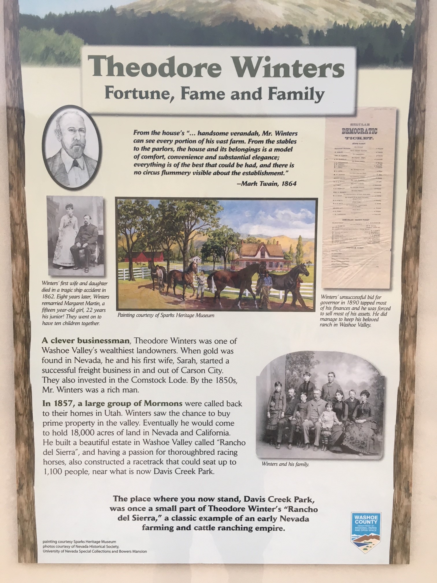
Davis Creek Regional Park was once a part of the 4,000 acre Winters Ranch. The ranch was well known in the early 1900's for its Thoroughbred horses. A race track was located near what is now the park entrance. During the winter, ice was cut on the park pond and used in the mines of Virginia City and for domestic use. Much of the timber on the hillsides above the park was cut for lumber in the late 1800's. The scenic area around the pond was a favorite spot for the Winter's family picnics and gatherings during the summer months. Today, the large pines add to the peaceful atmosphere of the park which was opened to the public in 1968.
Davis Creek Regional Park lies on the east side of the Sierra Nevada Mountain Range which includes Slide Mountain and Mount Rose. Contrary to what most people believe, Mount Rose ski area is not on Mount Rose, but located on Slide Mountain. Mount Rose is the large mountain to the north of Slide Mountain. On May 30th, 1983 around about noon, there was a devastating rock and soil slide. The winter of 1982/1983 was unusually wet and brought a record snowpack. But with an unusually warm spell in late May, high runoff occurred. The runoff infiltrated into the subsurface eventually causing a large avalanche of rockfall and debris. The avalanche damaged a small reservoir which further triggered slides and torrents of debris streaming downward over the alluvial fan (debris field) of Ophir Creek into Washoe Valley. Geological studies suggest that similar rock slides have happened at least nine times in the past 50,000 years.
Activities: BBQ/Picnicking, Bird Watching, Fishing, Camping, Hiking/Walking, Horseback Riding, Horseshoes, Volleyball, Interpretive Programs, Junior Ranger Program, Photography
Facilities: Lakeview Group Picnic Area, Individual Picnic Areas, RV Group Camp Area, Tent Group Camp Area, Equestrian-friendly Trailhead, Outdoor Amphitheater, Fishing Pond